Snowfields
Snowfields in the Flora of Victoria system of natural regions (Conn 1993) comprises the IBRA 7 Victorian Alps and Snowy Mountains subregions. In the current system of Victorian bioregions these are merged into Victorian Alps.
Location
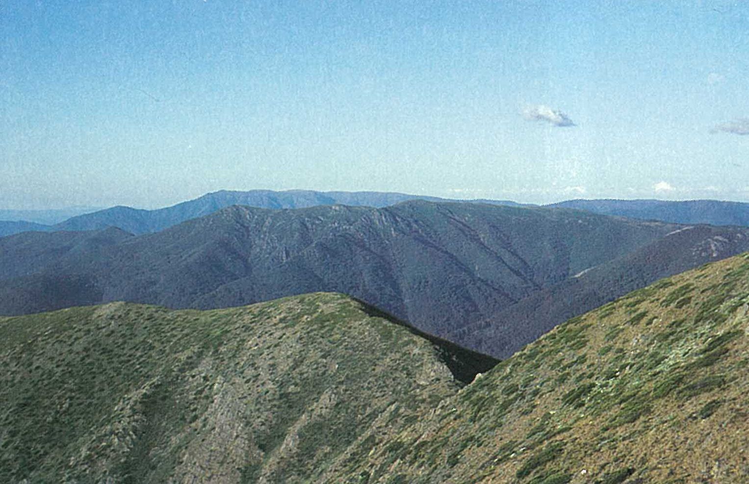
The Snowfields Region is naturally defined as the area that extends up from the lower limit (during winter) of regularly snow-covered ground (generally between 900 and 1300 metres). This altitude range approximates to the lower limit of Eucalyptus delegatensis-dominated forests. The mapping of this region has proved difficult because of the highly dissected nature of the terrain. Furthermore, although montane, sub-alpine, and alpine conditions are generally zoned according to elevation (Costin 1957), temperature inversions in valleys and upland plains situated at montane elevations frequently produce high mountain conditions. Areas where communities of E. delegatensis occur without associated sub-alpine or alpine communities (e.g. Mt Donna Buang, Mt Ellery and Mt Macedon) have not been included within the Snowfields Region.
There are several outliers, namely Mt Buffalo, Lake Mountain–Mt Torbrek, Mt Baw Baw, Mt Singleton, and Mt Skene.
Major grids R, S, V and W. Approximate area 6495 km2.
Major landforms
The high mountain region of south-eastern mainland Australia is part of an uplifted plateau that is bounded mostly by dissected valleys. The ‘palaeoplain’ (Mesozoic low-level plain) in Victoria is so dissected that only isolated small plateaus remain (now known as the High Plains of Victoria) (Ollier, in Barlow 1986, fig. 3). Examples of these isolated plateaus are the Baw Baw Plateau, the Buffalo Plateau, the Dargo High Plains, and the Bogong High Plains. Before and throughout the last glacial period the Victorian alps were probably eroded by normal rivers that had fairly low gradients on a plateau (glacial activity being confined to a small part of the Kosciusko range) (Ollier, in Barlow 1986).
The average elevation of this region is higher than the other regions, with the plateaus lying mainly at elevations of between 915 and 1525 metres (Hills 1940). Several peaks are above 1800 metres (e.g. Mt Bogong, 1986 m; Mt Feather-top, 1922 m; Mt Hotham, 1862 m; Mt Buller, 1804 m). The Buffalo and Baw Baw Plateaus represent remnants of an Upper Devonian granitic intrusion that has been uplifted and deeply eroded, whereas the Dargo and Bogong High Plains consist mostly of gneisses, with Basalt Hill, Mt Jim, Ruined Castle and other small areas being flat-topped lava residuals. Most of the remaining high country (e.g. Mt Howitt, Mt Wellington) comprises sandstones and mudstones, a notable exception being the Snowy River Volcanics of the Cobberas and nearby ranges (refer to Hills 1940; and Douglas, this volume; for further details). There is a wide variety of soil types, ranging from coarse lithosols, through alpine humus soils, to peats and snowpatch soils (Costin, in Barlow 1986; Gibbons and Rowan, this volume).
Climate
The prevailing north-westerly to south-westerly winds provide most of the predominantly winter precipitation. In winter the precipitation is mainly as snow, and in summer it is often, but not always, as heavy thunderstorms. The average annual precipitation is about 750–2000 mm occurring over about 120–140 days per year (subalpine tract), and 1750–3000 mm in about 130–150 days (alpine tract) (Costin 1957). During summer, the mean monthly maximum temperatures rise to about 16–24°C (subalpine tract), and to about 10–16°C (alpine tract). During winter the mean monthly minimum temperatures fall to about –4 to –1 °C (subalpine tract), and to below – 4°C (alpine tract). The mean monthly minimum temperatures are less than or equal to 0°C for about 6–8 months. See also ‘Climate of Victoria’ (this volume).
Vegetation
For extra general information, the detailed studies of the alpine vegetation of Carr and Turner (1959), Carr (1962), McDougall (1982a, 1982b, 1982c, 1984, 1985), Ashton and Hargreaves (1983), Walsh, Barley and Gullan (1983, 1984, 1986), Williams (1985, 1987), Williams and Ashton (1987a, 1987b), should be consulted.
Montane forests and woodlands
Eucalyptus delegatensis forests
Eucalyptus delegatensis-dominated tall open-forests (reaching heights of 60–70 metres) or tall woodlands occur in well-drained, deep soils on moderately steep slopes at elevations of 900–1500 metres. The mean annual precipitation (mostly as rain, although snowfalls are common in winter) varies from 1000–1500 mm, with below 0°C temperatures for 3–4 months during winter (Beadle 1981). The understorey is mesomorphic, and usually with an abundance of tree-ferns. The common understorey species include Acacia frigescens, A. melanoxylon, Atherosperma moschatum, Bedfordia arborescens, Dicksonia antarctica, Pomaderris aspera, Tasmannia lanceolata and Nothofagus cunninghamii (at Mt Baw Baw this latter species extends into the Snow-gum woodlands). As the sites become less favourable (drier or with poorer soils), Eucalyptus dalrympleana occurs as a co-dominant and becomes progressively more abundant. The understorey also becomes xeromorphic. The common understorey species include Acacia dealbata and Lomatia fraseri. The montane communities dominate the hilly to mountainous country below the Snow-gum woodland, and often form an ecotonal association with Eucalyptus pauciflora. On the wetter (western) slopes of the Bogong High Plains E. delegatensis-dominated forests occur below Snow-gum woodland, whereas the eastern (rainshadow) slopes near Omeo (Eastern Highlands) support a drier forest type (montane sclerophyll woodland), typically of E. rubida, E. macrorhyncha and/or E. dives. Contrary to this, near Mt Hotham, this community occurs on slopes with an easterly aspect, whereas E. pauciflora occurs on slopes with a westerly aspect, both at similar altitudes. At lower altitudes, the montane woodland/forest forms ecotonal associations with E. cypellocarpa, E. radiata and E. viminalis. However, the transition from the forests of lower elevations to the montane forest is frequently very distinct. For example, near McKinnons Corner (at about 1000 metres altitude), on the main road to the top of the Mt Buffalo plateau, there is a readily recognizable change from the Eucalyptus mannifera/E. rubida-dominated montane sclerophyll woodland to the E. delegatensis-dominated montane forest.
Snow-gum woodland
Eucalyptus pauciflora and E. niphophila (Snow-gums) usually dominate woodlands at elevations of about 1100–1837 metres, but commonly extend to lower altitudes in areas of cold air drainage and frost hollows. Disjunct communities of E. pauciflora occur in other regions (e.g. Grampians and Midlands; refer to these regions for details). This community occurs on a wide range of soil types (Costin 1954), but the soils are consistently rich in organic material and never waterlogged. The closed- or open-heathland communities (see below) usually extend into the Snow-gum woodland. Hence, the understorey typically comprises those species that occur in these heathlands. The ground-layer is characteristically dominated by Poa spp. A mallee-like form of E. pauciflora occurs at Mt Hotham (Beadle 1981, fig. 11.1), with an understorey of Bossiaea foliosa and Ozothamnus hookeri. Localized populations of Eucalyptus mitchelliana associate with Snow-gum woodland on Mt Buffalo.
The E. stellulata alliance is often associated with E. pauciflora. However, it replaces the latter species on waterlogged soils (Figure 6.24). It commonly occurs on lower slopes in frost-pockets occupied by Poa-dominated grasslands.
The E. niphophila alliance occurs at higher altitudes (to treeline, about 2000 metres) than E. pauciflora. The trees are 6–10 metres high, and are usually wind-shorn. The mean annual precipitation is 750–2000 mm, and snow lies for 1–4 months (Beadle 1981). The understorey is discontinuous, and typically includes Bossiaea foliosa, Grevillea australis, Orites lancifolia and Oxylobium alpestre. The ground-layer is usually dense, with the common species including Celmisia asteliifolia (sensu lato), Danthonia nudiflora, Poa hiemata and Ranunculus spp. This woodland grades into Eucalyptus pauciflora woodland at lower elevations, whereas at higher elevations it is replaced by heathlands and grasslands.
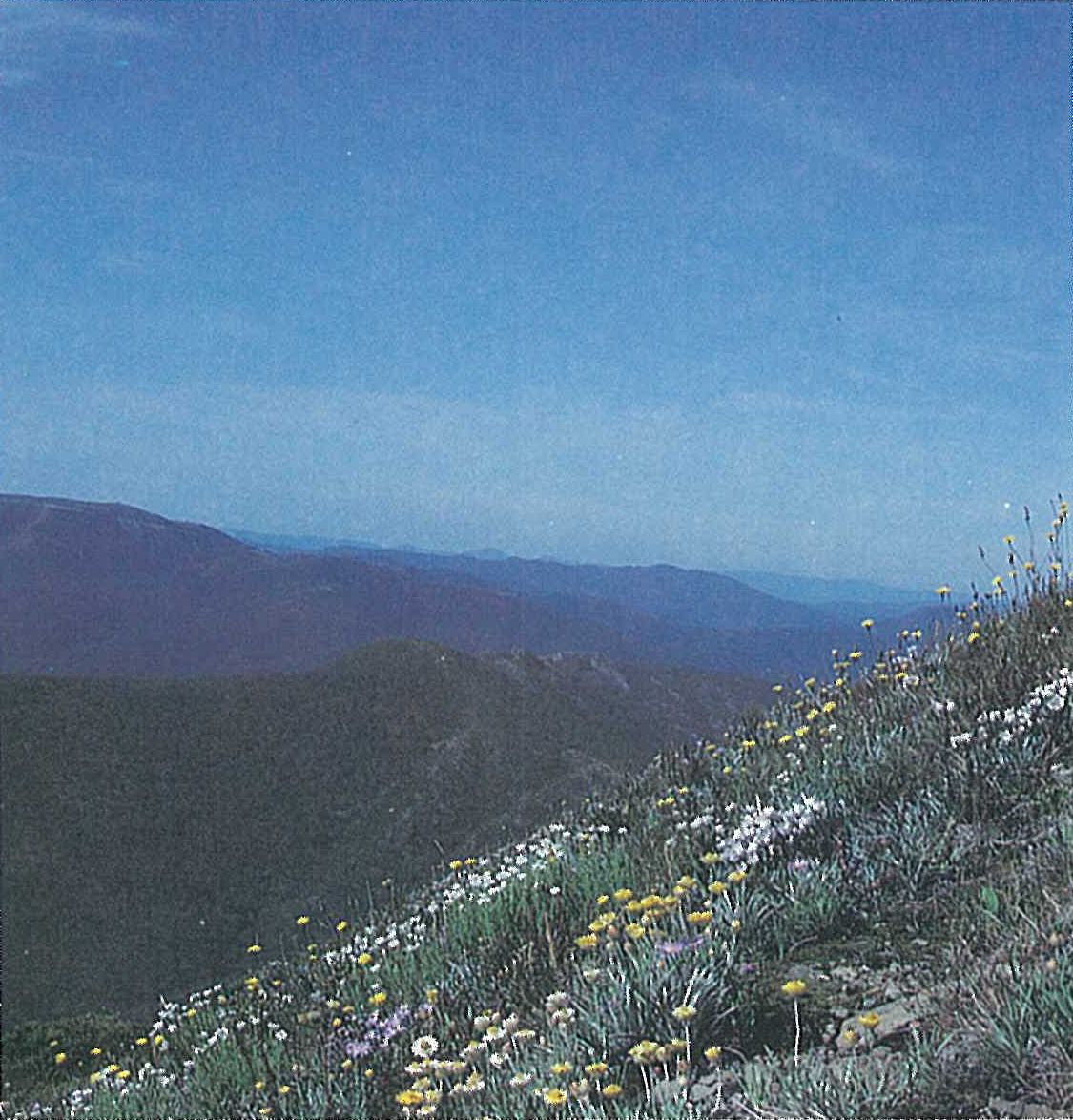
Heathlands
Closed-heathlands
A closed-heath community is common near the treeline. The tall shrub canopy (1–2 metres high) is very dense, such that understorey plants are sparse. Characteristically, Bossiaea foliosa, Orites lancifolia, Oxylobium alpestre and Prostanthera cuneata provide most of the cover. Other common species include Gonocarpus montanus, Grevillea australis, Hovea montana and Poa fawcettiae. Hymenanthera dentata, Pimelea ligustrina and P. axiflora subsp. alpina are less common components of this community. Drier sites are dominated by Acacia alpina, Baeckea ramosissima and Phebalium squamulosum subsp. alpinum.
Podocarpus lawrencei forms a closed-scrub/heathland (at elevations of 1400–1740 metres) in block streams, well-drained rocky sites, and on boulder-scree slopes on the Bogong High Plains (e.g. Timms Lookout—north of Mt Spion Kopje and Mt Jim), Mts Higginbotham, Buffalo, Buller (Scott 1974), Cobberas and Howitt. Although few other species occur in this community, common associates include Blechnum penna-marina, Olearia phlogopappa, Polystichum proliferum and Tasmannia xerophila. A low alpine shrubland subcommunity (ALP 2.1 of Walsh, Barley & Gullan 1983, 1984, 1986), dominated by Oxylobium alpestre, Olearia phlogopappa, *Rumex acetosella, Tasmannia xerophila and Stellaria pungens, is possibly a grazing- and/or fire-induced variant of the Podocarpus heathland. This subcommunity occurs on the upper slopes of Mts Buller, Magdala and Stirling.
Open-heathlands
Open-heathland is the most common community on the Bogong High Plains. The shrub-layer is short (0.3–0.7 metre high), with the spaces between the shrubs occupied by herbs and tussock grasses. The shrub-layer is very diverse, with Grevillea australis, Hovea montana, Leucopogon hookeri and Orites lancifolia the most common components of the community (Plate 6f). Other common species include Bracteantha subundulata, Olearia phlogopappa var. subrepanda, Ozothamnus alpinus, O. hookeri, Stylidium graminifolium and Wahlenbergia ceracea. The Alpine Walking Track from Cope Saddle to Mt Jim on the Bogong High Plains passes through extensive examples of open-heathland, alternating with Poa hiemata grassland and Poa costiniana grassland. The Bogong High Plains Tourist Road (especially between Mt Cope and Langford Gap) also passes through large areas of open-heathland. Other examples of this community occur near Mt Nelse, Hollonds Knob, Marm Point, Mt Buller (Scott 1974) and below the Poa hiemata grassland on Mt Bogong and Hooker Plateau.
The rocky alpine areas support another open-heathland subcommunity that is characterized by rock-loving herbs (e.g. Brachyscome rigidula, Crassula sieberiana, Leucochrysum albicans and Luzula novae-cambriae) (Plate 6g). It occurs in rocky gullies, on shale and scree slopes, in rocky crevices and on isolated rocky outcrops (e.g. Mt Buffalo, the Cobberas, the Twins, Mt Blue Rag, the rocky peaks of the Delatite, Jamieson and Macalister River catchments, and Ruined Castle on the Bogong High Plains). The dominant grass is usually Poa fawcettiae, P. hothamensis or P. phillipsiana).
Kunzea heathland
This heathland is characteristic of the alpine region, occurring at elevations of 1380-1740 metres. The dominant species is Kunzea ericifolia. Here, it is a prostrate shrub that spreads over the boulders and gravelly soils. Walsh, Barley and Gullan (1983, 1984, 1986) recognize four subcommunities within the Kunzea heathland community. Common species occurring in this heathland include Asperula gunnii, Brachyscome spathulata, Carex breviculmis, Epacris gunnii, Hovea montana, Leucochrysum albicans subsp. alpinum, Micrantheum hexandrum (on Mt Buffalo), Microseris lanceolata, Poa fawcettiae, P. phillipsiana, Senecio lautus and Trisetum spicatum. This community is well developed on the Bogong High Plains and on Mt Buffalo, Mt Wellington and the Snowy Range area. The original character and distribution of these communities have been significantly modified by grazing and fires (Costin 1957).
Subalpine and alpine tussock-grasslands
Tall, robust tussocks of Poa costiniana form a dense grassland in association with relatively few other species. Shrubs are rare. Species commonly occurring in this grassland include Brachyscome tadgellii (especially in shallow depressions), Cardamine lilacina, Colobanthus affinis, Microseris lanceolata and Veronica serpyllifolia. This community occurs on all basalt cappings of the Bogong High Plains (McDougall 1982b, 1982c, 1984) (e.g. at Ruined Castle). The alpine tracks from Cope Saddle and from Basalt Temple to Ta-wonga Huts pass through extensive examples of this community. Depressions and small creeks, with their associated communities (e.g. Carex appressa and Poa helmsii), occur throughout the Poa costiniana grassland.
Poa hiemata-dominated grassland occurs at lower elevations (usually occurring below the P. costiniana grassland) (e.g. Pretty Valley, alpine track near north of Mt Cope, and the Howitt Plain), mainly on soils derived from metamorphic rocks (McDougall 1982b, 1982c, 1984, 1985). This community occurs on flat to gently sloping areas. Shrubs are either absent or sparse. This grassland is generally more open than the Poa costiniana grassland, with herbs usually abundant between the tussocks. Common species include several species of Craspedia and Euphrasia, Luzula modesta × L. novae-cambriae and Stackhousia monogyna. On the Howitt Plain the most common species in this community include Asperula gunnii, Brachyscome decipiens, Cotula alpina, Hypericum japonicum, Ranunculus graniticola, R. gunnianus and Viola betonicifolia. One of the weediest and species-poor subcommunities of Poa hiemata grassland occurs on the Dargo High Plains (sub-community ALP 7.3 of Walsh, Barley & Gullan 1983, 1984, 1986). Areas of the Dargo High Plains are heavily stocked and grazed by cattle.
Small tree-bordered, subalpine grasslands occur at elevations of 1200–1600 metres (e.g. Wire Plain—east of Hotham Heights), where the accumulation of cold air prohibits the growth of Eucalyptus pauciflora. Tall tussocks of Poa labillardierei dominate the grassland, with several species occurring between the tussocks (e.g. Ranunculus lappaceus and R. pimpinellifolius, and several species of Daviesia, Dianella, Diuris, Hakea, Hypericum and Hypoxis). These grasslands are generally surrounded by Eucalyptus stellulata woodlands.
Subalpine and alpine bog communities
Subalpine and alpine bog communities are restricted to permanently wet drainage lines and the upper reaches of streams. Walsh, Barley and Gullan (1983, 1984, 1986) classify the bog communities as wet alpine heathland. Sphagnum is the characteristic moss of these bogs. On the slightly drier sites, tall shrubs, such as Epacris paludosa, often form an almost impenetrable upper stratum, with Sphagnum less abundant. This community is well developed on the Bogong High Plains (e.g. along the upper reaches of Cope Creek, and in the Langford Gap area), Mt Baw Baw, the Snowy Range area, Mt Buffalo, Dargo and Davies Plains, and at Echo Flat (Lake Mountain). The bog community characteristically occurs on black peat up to at least 2 metres deep (Ashton & Hargreaves 1983), frequently overlying a dark grey clay and gravel zone. Sphagnum subsecundum occupies the wetter sites (hollows) of the bogs (e.g. forming a subalpine bog community at Echo Flat, Lake Mountain), whereas Sphagnum cristatum occurs on the drier hummocks (Ashton & Hargreaves 1983) (Figure 6.25). Common species of the bog include Astelia alpina, Asperula gunnii, Baeckea gunniana, Celmisia asteliifolia (sensu lato), Colobanthus affinis, Craspedia spp., Empodisma minus, Gentianella diemensis, Myriophyllum pedunculatum, Orites lancifolia, Richea continentis and Stackhousia pulvinaris. Many of these species colonize the slightly drier hummocks of the bog.
Land use
During the warmer months (principally November to April), the region is used for leisure activities, particularly bushwalking and sightseeing, and is grazed by cattle. In winter the principal leisure activity is snow skiing, with limited bush-walking in the more accessible areas. Some modification of the alpine vegetation has occurred as a result of clearing and/or revegetation of downhill ski-slopes and alpine resorts. Selective grazing of some native species and general trampling (which is non-selective) by cattle has also modified the vegetation in most parts of the region (Costin 1957; Carr & Turner 1959; Wimbush & Costin 1979; van Rees 1982, 1984; van Rees & Hutson 1983). On the Bogong High Plains cattle spend the largest proportion of their grazing and resting time in the open grassy-heath and grassland communities (van Rees & Hutson 1983). Bare ground is created in both grasslands and heathlands by the activity of cattle as a result of grazing, trampling, urine scalds and deposition of dung (Carr & Turner 1959; McDougall 1982a; Williams 1985). These bare areas provide a suitable site for the establishment of shrub seedlings (Williams & Ashton 1987b). Williams and Ashton (1987b) conclude that the likely consequences of continued cattle grazing are difficult to predict, but suggest that current grazing practices will continually provide microsites suitable for the establishment of shrub seedlings in preference to grassland species. Continued grazing within the Bogong National Park is not compatible with strict values of nature conservation, especially as the alpine and subalpine flora of Australia has evolved in the absence of intense grazing pressure by herbivores in general, and hooved animals in particular.
National Parks
- Alpine (in part)—627 680 ha;
- Baw Baw (in part)—13 300 ha;
- Mount Buffalo (in part)—31 000 ha.
State Park
- Lake Mountain (proposed)—2400 ha.
Source: Conn, B.J. (1993) Natural regions and vegetation of Victoria, in: Foreman, D.B. and N.G. Walsh (eds), Flora of Victoria Volume 1, pp. 79–158, Inkata Press.