Midlands
The Midlands region in the Flora of Victoria system of natural regions (Conn 1993) comprises the Goldfields, Central Victorian Uplands and Northern Inland Slopes regions in the current system of bioregions in Victoria.
Location
The northern and north-eastern boundary of the Midland Region approximates to the southern and south-eastern limits of the flat alluvial plains of the Riverina. In the north, the granitic outcrops of the Terrick Terrick area and those of the Warby Range area form outliers surrounded by the Riverina. In the north-west, this region adjoins the Wimmera. This boundary is frequently broad (up to a few kilometres wide), so that there is often a gradual transition from one region to the other. The western boundary coincides with the sandy outwash slope of the eastern ranges of the Grampians. The southern boundary represents the northern limit of the basalt lava flows of the Victorian Volcanic Plain that characteristically are almost treeless plains, except where the volcanic cones have well-developed forests remaining. This boundary is usually distinct, except in areas that have been extensively cleared. An outlier occurs in the Mt Mercer area (near Meredith). The south-eastern boundary approximates the 610-metre altitude contour shared with the Eastern Highlands, with the Eltham-Plenty-Coldstream area forming a disjunct area surrounded by the Victorian Volcanic Plain, Gippsland Plain and Eastern Highlands Regions.
This region is continuous with the South-western Slopes Region of New South Wales (Anderson 1947, 1961; Jacobs & Pickard 1981). It is recommended that the south-western boundary of the South-western Slopes should be as here modified (refer to map of Natural Regions of Victoria, endpapers), so that it ends near Albury–Wodonga, not near Yarrawonga (cf. Jacobs & Pickard 1981).
Major grids H, J, L, M, N, R, S, U and V. Approximate area 32 590 km2.
Major landforms
The major landforms that characterize this region are the scattered mountain ranges that are separated by broad plains or broad undulating country. The plains are covered with alluvial deposits. Low ironstone-ridges of sedimentary origin occur to the north of Bendigo. The mountain ranges are composed of resistant rocks, such as hornfels (e.g. Mt Tarrangower, Mt Ararat, and Big Hill south of Bendigo), granites (e.g. Mt Cole, Mt Buangor, Ben Nevis, and the You Yangs), and Devonian dacites (e.g. Mt Macedon range). The mountain ranges are generally small, with the highest ranges being The Hump– Mt Macedon (1011 metres), Mt Buangor (989 metres), Mt Langi Ghiran (925 metres), Mt Cole (899 metres) and Ben Nevis (877 metres). Large areas of this region form part of the western goldfields of Victoria, and characteristically these soils are usually quartz-rich, being derived from vein quartz. For detailed discussion of the origin of the landforms of the region, see Anon. (1980a); Ollier, in Barlow (1986); Douglas (this volume); and Gibbons and Rowan (this volume).
Climate
This region has a relatively uniform climate; however, the various mountain ranges modify the local climate. The region experiences a temperate climate, with warm, dry summers (with January usually being the driest month) and cool to cold, wet winters (with June generally being the wettest month). Rain-bearing winds move across the plains in a south-westerly or north-westerly stream, and are lifted as they approach the ranges. Consequently, the plains generally receive less rain than the adjoining ranges. The mean annual rainfall varies from about 400 mm (in the north) to at least 750 mm (in the Pyrenees) and 719 mm (Ballarat) in the south. The mean annual rainfall for much of the northern slopes varies from 400–500 mm. January and February are the warmest months (Anon. 1978 & 1980a), with the northern areas being hotter than the more southern localities. The lowest temperatures occur in July. Frosts are common throughout the region (Anon. 1978). See also ‘Climate of Victoria’ (this volume).
Vegetation
Large areas have been cleared for agriculture, with only remnants of the original vegetation occurring throughout much of the region.
Wet woodlands and forests
Snow-gum woodland
The Eucalyptus pauciflora (Snow-gum) dominated community is poorly developed, and is restricted to the summit areas of some of the higher peaks (e.g. Mt Cole State Forest and Mt Macedon area). At Lookout Hill (Mt Cole State Forest) a small snow-gum woodland occurs amongst the granitic boulders with a Poa sp.-dominated ground-layer. Many exotic grasses are also present as a result of the disturbance caused by communications installations. Common herbs include Brunonia australis, Lomandra longifolia and Wahlenbergia spp.
Eucalyptus pauciflora (Snow-gum)–E. ovata (Swamp Gum)–E. viminalis (Manna Gum)–E. rubida (Candlebark) forest
These species once formed widespread open-forests on the moderately fertile soils of the Steiglitz and Ballarat plateaus (Scarlett, pers. comm. 1988). The understorey was grassy, similar to that found on the Dundas Tableland (Wannon Region).
Damp/wet sclerophyll forest
Eucalyptus obliqua–* E. radiata, open- to tall open-forests (10–40 metres high) are very widespread throughout the region. Locally, either species may form pure stands (e.g. *E. obliqua in the Wombat State Forest) or several species may occur as co-dominants. For example, in the Mt Cole State Forest E. rubida occurs as a co-dominant on the lower eastern slopes, with E. globulus subsp. bicostata co-dominant in some areas. The understorey of the latter eucalypt characteristically consists of Acacia dealbata, A. melanoxylon and Exocarpos cupressiformis, with the ground-layer commonly dominated by Pteridium esculentum. Eucalyptus viminalis is usually present, and may dominate the wetter sites, particularly along watercourses. Near O’Briens Crossing, on the Lerderderg River, this species dominates a riparian community that has an understorey of Acacia dealbata, A. melanoxylon, A. verticillata, Bursaria spinosa, Cassinia longifolia, *Genista monspessulana, Goodenia ovata, Hakea sericea, Leptospermum lanigerum, Pomaderris aspera, Prostanthera lasianthos and P. rotundifolia, with the aquatic species *Myriophyllum aquaticum and Triglochin procerum common in the flowing water. On the drier slopes above the river, the understorey is largely replaced by a ground-layer dominated by Poa spp.
Fern gullies
Fern-dominated communities are usually small, and very scattered in the wetter gullies of the mountain ranges. This community can be seen at the Ferntree Waterfall picnic area and Richards camping ground, both in the Mt Cole State Forest. The most common tree-fern is Dicksonia antarctica. The other ferns that characterize these fern gullies include Blechnum nudum, B. wattsii, Cyathea australis, Pteridium esculentum and Todea barbara. The understorey characteristically consists of the species found in the Eucalyptus obliqua/E. radiata-dominated wet sclerophyll forest. The community is dominated by E. viminalis (up to about 40 metres high), with E. obliqua, E. radiata and E. rubida further up the slopes and along the ridges.
Dry woodlands and forests
The vegetation of this region is commonly modified by changes in aspect. In general, the northern slopes of the Great Dividing Range are much drier than the southern slopes. Frequently, the eastern slopes are drier than the western slopes.
Eucalyptus dives (Broad-leaf Peppermint)
This species is widespread and fairly common in low open-forests and woodlands, often on quartz-rich soils. Characteristically it occurs on drier slopes in poor shallow soils (e.g. north-western slopes along O’Briens Road, Lerderderg Gorge). Here, it forms a low woodland (7–8 metres high), with the shrub-layer dominated by Hakea sericea and the ground-layer dominated by Poa spp. A slightly taller woodland, with Eucalyptus dives and E. macrorhyncha co-dominant, occurs in the Pyrenees.
Eucalyptus goniocalyx (Long-leaf Box)
This species is widespread and fairly common in dry open-forests and woodlands, often on quartz-rich, poor skeletal soils. The community is similar in structure to that of the Eucalyptus dives alliance. On the lower north-western, northern and north-eastern slopes of Mt Avoca (the Pyrenees), E. goniocalyx-dominated low forest/woodland occurs. The shrub-layer is open, and consists of Bursaria spinosa, Ozothamnus obcordatus and Senecio linearifolius. The ground-layer is dominated by grasses, *Briza maxima, Danthonia spp., Dianella revoluta and Poa spp. Eucalyptus goniocalyx/E. aromaphloia-dominated woodland occurs on the granite-derived, sandy outwash slopes of Langi Ghiran. In the Ararat–Stawell area E. goniocalyx is associated with E. leucoxylon, with E. macrorhyncha often mostly on the hills. The soil is a heavy orange clay, quartz-rich, with coarse sand derived from a conglomerate. The shrub- and ground-layers consist of Acacia pycnantha, Astroloma humifusum, Gahnia radula, Kunzea ericoides and Ozothamnus obcordatus. In this area Eucalyptus leucoxylon becomes increasingly dominant on the deeper alluvial soils, with E. camaldulensis and E. melliodora. Much of this community (e.g. between Concongella Creek and Great Western) has been cleared for agricultural purposes.
Eucalyptus macrorhyncha (Red Stringybark)–E. polyanthemos (Red Box)
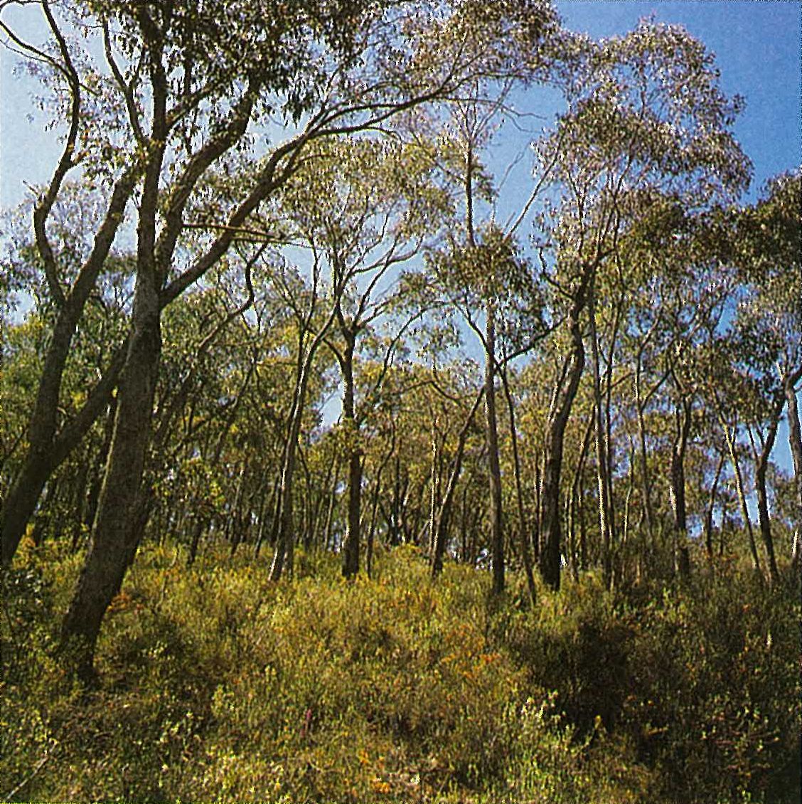
This alliance is common on the drier northern slopes of the Great Dividing Range. Eucalyptus macrorhyncha tends to be restricted to the ridges, frequently with E. tricarpa confined to the flatter areas. Both E. macrorhyncha and E. polyanthemos often form small pure stands (e.g. E. macrorhyncha in parts of the Meredith State Forest) (Figure 6.15), but usually they occur together as co-dominants (with other species) or individually with other species. For example, E. macrorhyncha and E. polyanthemos occur with E. dives and E. nortonii south of Beechworth, and with E. blakelyi south-west of Wodonga. North of Beechworth E. macrorhyncha/E. blakelyi/Callitris endlicheri-dominated woodland occurs on auriferous soils. At Mt Pilot E. blakelyi, E. macrorhyncha, E. nortonii and Callitris endlicheri occur in the skeletal soils on the granitic outcrop. Eucalyptus tricarpa occurs with E. macrorhyncha on the upper eastern slopes of the Brisbane Ranges, and with E. polyanthemos on McLeans Highway, south of Marshalls Road, Brisbane Ranges. In the Chiltern State Park, E. macrorhyncha and E. polyanthemos co-dominate with E. sideroxylon. The shrub-layer is dominated by Acacia pycnantha, Brachyloma daphnoides, Chrysocephalum semipapposum, Dianella revoluta, Dillwynia phylicoides, Exocarpus cupressiformis, Grevillea alpina, Hibbertia obtusifolia, Hibbertia sp. aff. stricta and Pultenaea foliolosa (Plate 6O). The ground-layer is commonly bare over large areas, or is covered with leaf and bark litter, and mosses (e.g. Campylopus introflexus, Hypnum cupressiforme var. tectorum and Triquetrella papillata).
Eucalyptus polyanthemos frequently occurs as a co-dominant in a mixed forest. Near Lake Nillah-cootie it occurs with E. cypellocarpa, E. goniocalyx and E. radiata. This area is transitional between the Midlands and the Eastern Highlands Regions. In the Swanpool area the E. polyanthemos–E. melliodora alliance grades into a mixed open (partlycleared) woodland dominated by E. goniocalyx, E. macrorhyncha, E. polyanthemos and E. camaldulensis on the flatter terrain that is transitional between the Midlands and Riverina Regions. Near Beaufort the two species occur with E. aromaphloia, E. melliodora, E. obliqua and E. rubida. E. dives, E. goniocalyx, E. macrorhyncha and E. polyanthemos dominate a dry sclerophyll forest that occurs on the skeletal soils of the undulating lowlands and foothills in the eastern suburbs of Melbourne (such as at Eltham).
Eucalyptus microcarpa (Grey Box)–E. tricarpa (Red Ironbark)
This alliance is common in areas where the mean average rainfall is less than 635 mm per annum (e.g. near Bendigo, Castlemaine, Maryborough, Rushworth, St Arnaud and Stawell) (Plate 6P). In the Chiltern area E. tricarpa is replaced by the closely related E. sideroxylon. Eucalyptus microcarpa-dominated open-woodlands occur on shallow soils of the hills and ridges in the Inglewood Flora Reserve (Walsh 1987). The understorey comprises a moderately dense shrub-layer of Acacia calamifolia. The ground-layer is rich in herbaceous species (e.g. Cheilanthes austrotenuifolia, Gonocarpus elatus, Hypoxis glabella and Wurmbea latifolia). Eucalyptus microcarpa/E. Tricarpa/E. leucoxylon open-forests (up to 20 metres high) occur on the flatter terrain, in coarse, often quartz-rich alluvium. The shrub-layer is similar to that found in the Eucalyptus viridis-dominated mallee. On sites with deeper soils (usually on the southern and eastern slopes) a dense shrub-layer develops. The common shrubs include Correa reflexa, Olearia teretifolia and Westringia eremicola. Eucalyptus leucoxylon is more common along watercourses and sometimes occurs in pure stands. The shrub-layer is very sparse, and the common herbs include Einadia hastata, Hydrocotyle laxiflora, Plantago varia, Ranunculus pumilio and Stipa elegantissima (Walsh 1987).

Eucalyptus obliqua (Messmate)–E. macrorhyncha (Red Stringybark)–E. baxteri (Brown Stringy-bark
In the Brisbane Ranges an association of Eucalyptus obliqua, E. macrorhyncha and E. baxteri dominates a low open-forest or woodland, occurring on Tertiary lateritic sandy clay soils. E. dives is often associated with this community, with E. radiata a relatively minor species in the dissected areas on the cooler slopes. The heathy understorey is dominated by Banksia marginata, Grevillea chrysophaea, Hakea sericea and Xanthorrhoea australis. The ground-layer is dominated by Lepidosperma semiteres. This community is very similar to the Eucalyptus baxteri/E. obliqua-dominated dry sclerophyll forest of the Otway Plain.
Mallee and woodland communities
Four species of mallee occur in this region, each forming distinctive associations within gravelly-sediment mallee (Cheal & Parkes, in Noble & Bradstock 1989).
Eucalyptus viridis (Green Mallee)
The Eucalyptus viridis association occurs in the Inglewood and Tarnagulla Flora Reserves. This relatively open association has a structurally and floristically diverse shrub- and ground-layer. The shrub-layer is characterized by Acacia acinacea, A. pycnantha, Cassinia arcuata, Ozothamnus obcordatus and Pultenaea prostrata. The sparser ground-layer typically consists of Bracteantha viscosa, Daucus glochidiatus, Dianella revoluta and Senecio tenuiforus. In shallower or skeletal soils, particularly on ridges and crests, Acacia calamifolia, Baeckea behrii, Eucalyptus viridis and Melaleuca uncinata form a dense, upright shrubland to about 5 metres high (Walsh 1987). The ground-layer is relatively sparse, characteristically with Brachyscome spp., Glischrocaryon behrii, Helipterum (sensu lato) spp., Hibbertia riparia and Thysanotus patersonii. Walsh (1987) records a variant of this association that lacks or has a reduced Eucalyptus component. This variant occurs on sites of impeded drainage or on the sandy outwash slopes. The species commonly occurring in this variant include Allocasuarina muelleriana, Baeckea crassifolia, Calytrix tetragona, Dampiera dysantha and Platysace lanceolata.
Eucalyptus polybractea (Blue Mallee)
The Eucalyptus polybractea association occurs mainly on flat areas or depressions between the rises that support E. viridis (Walsh 1987) in the Inglewood and Tarnagulla areas. Frequently E. behriana and E. viridis occur as co-dominants. The shrub- and ground-layers characteristically consist of Acacia lineata, Calytrix tetragona, Glischrocaryon behrii, Melaleuca decussata, M. wilsonii and Phebalium obcordatum.
Eucalyptus behriana (Bull Mallee)
The Eucalyptus behriana association (e.g. at Long Forest Flora Reserve, north-east of Bacchus Marsh) has an understorey dominated by Melaleuca lanceolata and Rhagodia parabolica. The large areas between the mallees are commonly bare or covered with leaf and bark litter, Hypnum cupressiforme var. tectorum (a moss), and Einadia hastata. However, Einadia hastata is usually more closely allied to adjacent woodland communities than to the mallee communities.
A floristically-rich mallee community occurs to the north of Bendigo on low ironstone-ridges of sedimentary origin, in clayey and gravelly soils. This area is known as the ‘Whipstick mallee’, and is included in the Whipstick and Kamarooka State Parks. The mallee Eucalyptus species are E. behriana, E. froggattii (only in the Kamarooka State Park), E. polybractea and E. viridis. The shrub-layer consists of several species of Acacia (including A. williamsonii, which is restricted to this area), Dampiera, Glischrocaryon, Grevillea, Melaleuca and Prostanthera, with the herb-layer consisting of many orchids and annual herbs.
Heathlands
Although Leptospermum myrsinoides heathland is primarily restricted to the Otway Plain (refer below for further details), it is also present in the Brisbane Ranges of this region. The dominant species include Aotus ericoides, Epacris impressa, Hakea sericea, Leptospermum myrsinoides and Tetratheca ciliata.
Granite outcrop communities
An open-shrubland (dominated by Acacia deanei subsp. paucijuga) to open-heathland (dominated by Correa glabra, Dodonaea viscosa subsp. cuneata and Stypandra glauca) occurs on the granite out-crops (e.g. Mt Hope, Pyramid Hill and Terrick Terrick). Other common plants include Cheilanthes austrotenuifolia, Clematis microphylla, Drosera peltata, Isotoma axillaris, Lavatera plebeia and Pimelea linifolia. A few old trees of Allocasuarina verticillata occur at Mt Hope. The common grasses include Agrostis avenacea, Danthonia spp. and Stipa spp. In general, these communities are disturbed, and several weedy species are usually present.
Land use
Most of the region is privately owned, and is used for agriculture, such as sheep and beef-cattle grazing, crop production (wheat, barley and oats), dairying (limited amount) and mixed farming (including pigs and poultry). There are also small areas of fruit orchards (e.g. Harcourt) and vineyards for wine production (e.g. Avoca). Eucalyptus oil is harvested in a few areas (e.g. north of Bendigo, Inglewood, St Arnaud and Wedderburn). E. polybractea is the preferred species because of its high cineole content. Hardwood eucalypts are harvested for firewood, fencing timbers, railway sleepers and sawlogs (Anon. 1978). Softwood plantations of Pinus radiata (e.g. near Creswick) supply timber, veneers and pulp. Many areas, from Stawell (in the west) to Kyneton (in the east), contain gold-bearing sediments. Some of the most productive goldfields in Victoria were worked in this region. The most important fields were Ballarat, Bendigo, Castlemaine, Dunolly, Inglewood, Stawell and Wedderburn.
National Parks
- Brisbane Ranges—7517 ha; Fraser—3750 ha.
State Parks
- Enfield (proposed)—4400 ha;
- Chiltern—4300 ha; Kamarooka—6900 ha;
- Kara Kara—3840 ha; Kooyoora—3593 ha;
- Langi Ghiran—2695 ha;
- Lerderderg Gorge—14 100 ha;
- Mt Buangor—2400 ha;
- Mt Granya (proposed)—6180 ha;
- Mt Lawson (proposed—part in Eastern
- Highlands Region)—13 150 ha;
- Paddys Range—1670 ha;
- Terrick Terrick—2500 ha;
- Warby Range—6880 ha;
- Werribee Gorge—375 ha;
- Warrandyte—586 ha; Whipstick—2300 ha.
Source: Conn, B.J. (1993) Natural regions and vegetation of Victoria, in: Foreman, D.B. and N.G. Walsh (eds), Flora of Victoria Volume 1, pp. 79–158, Inkata Press.